When we first started cruising I wish that I had been more careful with recording and backing up our Routes, Tracks and Waypoints. For the first couple of trips I thought that I was saving the tracks on my handheld GPS receiver. I thought this was working well until we started to do longer trips and due to the small memory in the unit the previous track files eventually started to get over written. It wasn't until we saved the tracks off on to the computer I found to my horror there were great number of tracks missing.
After becoming more familiar with the handheld on the longer trips I found a way to save the active tracks on to the unit as we went along so they didn't get overwritten. I thought this was a solution until I found to save storage space on the unit the files were stripped of data and only a shell of the original track was saved. These were OK but trying to extract statistical data from them later didn't work.
After talking to some cruisers and discussing how I wanted to keep a record of our travels, we were told about OpenCPN. We downloaded and installed a copy, connected it up to the onboard instrument WiFi and away we went with positioning and AIS data. We found OpenCPN easy to use and before long this was where we did our passage planning and created waypoints, routes and clearing lines and were easily able to save off our tracks in GPX format.
So why go to all that effort to save the information. To state the obvious travelling through reef or sand bar infested waters is so much easier when you’re travelling on a track or route you’ve already successfully navigated. Anchoring is also a lot easier when you know where you or others have actually been able to get into and have dropped the pick.
 | ||
This is why we keep tracks, for the return journey.
|
While this may sound like a lot more work, after every passage when finalising the logbook we rename the track and give any waypoints created meaningful names and fill in any necessary information into the waypoint description box. With the tracks we enter the start and end port/town/anchorage and from experience we have found this certainly makes it easier and saves time to find the track if we want to do the trip again. We have been given waypoints and or tracks contained in large GPX files others have made, and it can take a bit of detective work to work out the right track and waypoints just by the numbers the system uses as default.
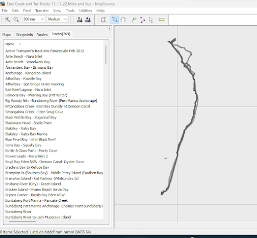
The three following screen grabs are from the Garmin Mapsource program.
 |
| The tracks tidied up and partial tracks joined or removed. After naming they are good to go and we can import them into the Layer directory for use when needed. |
 |
| The routes were also tidied up and we insured they didn't cross any obstacles' by overlaying them on Google Earth. |
If you interested to see what programs are available to tidy up these navigation data files here is a link:
Programs to Manipulate GPS Navigation Files
OpenCPN Route and Mark Manager
 |
| OpenCPN access to the Route and Mark Manager on the toolbar |
To save off the tracks is fairly easy, firstly open the Route and Mark Manager on the toolbar.
So now you have a library of Routes, Tracks and Waypoints backed up and you are now travelling back into the area. Perhaps you want to do some passage planning. What is the best way to display the data quickly and easily without merging the it with your current trips. We use the Layers function and this way we do not have to import the GPX file or files into the working directories. By using the Layers function the backed up contents is also safe from being corrupted or changed.
Keep in mind that when saving off your GPX files you don't have to save off tracks routes and waypoints in the one file. I find on a lot of occasions its easier to make three files, the three are smaller and importing or displaying them in layers is the same.
While the import GPX will do the job, we just don't unless we want to edit the information. This work often entails moving waypoints adding information into the properties or even changing the display scale. Any sort of edit we need to do, then we do save the data back into a new file and after checking its readable we will delete the imported information and use the file(s) as Layers.
If you want to import a GPX file you want to do an edit on or use and during the import you are questioned about duplicate entry's and you know there isn't any entry's in any of the tabs other than Layers you will need to remove the file from the Layers Directory, to import the whole file.


No comments:
Post a Comment