We have found a wonderful benefit of having our vessel navigation move into the digital age. Most electronic navigation systems produce collectable data in a variety of formats. While there can be an assortment of statistical and performance information collected from the different components of the on-board navigation system. I will focus on the data sets dealing with waypoints, tracks, routes and sonar logs. Most of the newer systems save the recorded data in a format called GPX. Sonar logs are the exception to this rule and does vary with model and brand of unit collecting the data.
 |
| GPX files have the ability to contain 1000's of waypoints and an enormous number of tracks and routes. |
Waypoints can have text information added to act as a memory jogger. For example, a reminder of the bottom type and the depth of an anchorage, or data about transiting through the area. Additional waypoint data can also include the local tidal station or function we have started to make good use of is an active link function. This works well when the OpenCPN chartplotter is running on a PC\laptop. This link can be used to open a .PDF file on your computer hard drive, a great way to store additional information about what’s happening at the waypoints surrounding area. The link can also open a web address if formatted correctly. As an example, a file stored in the C:\ directory can be opened at the selected page number of a cruising guide. This link file:/C:\Matilda Cruising Guide.pdf#page=1 will open the file ‘Matilda Cruising Guide.pdf ‘at the selected page and in this example will be page 1.
Programs to manipulate GPS files including .GPX (GPS Exchange Format). GPX the file extension of one of the most commonly used GPS file format. GPX, or GPS Exchange Format, is designed as a common GPS data format for software applications. It can be used to describe waypoints, tracks, and routes. The format is open and can be used without the need to pay a license fee. I will also mention some of the programs have the ability to look at and allow you to edit NMEA format files as well. Possibly not as popular as the other file types as this is usually the raw data from instruments and GPS/GNSS units.
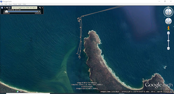
When passage planning another good reason for using some of these software tools is the ability to cross check your planned route on differing base maps or Google Earth.
The waypoint tracks and routes can also be checked on Memory Map charts, these are a copy of the official Australian charts. We find it saves drawing lines on the paper equivalent. Unfortunately unless you already have Memory Map charts then this tid bit if information won't be much help as they are no longer available.
However we use SASplanet to look over our planned routes now, and the main reason is due to being able to select a variety of different sources of satellite charts.
If you need to edit or manipulate GPX data files, older file types, or even NMEA data files there are several programs that should cover most formats. In no particular order, all but one of the programs were free downloads at the time of writing. As is usually the case when we first start to use this data, to create files or correct errors it can be confusing and time consuming. Although, with a little persistence once you start it doesn’t take long to become proficient.
Another post we have done is the way we navigate in the digital age. Read it here also check out the tab on the home page "Technical & Help Articles, OpenCPN, OpenPlotter, Navigation, Raspberry Pi " for other hints and tricks we have picked up along the way.
GPSbabel
I use this program to convert my Lowrance chartplotter tracks to GPX format, but this program has an enormous collection of formats from a wide variety of chart plotter brands to choose from.
https://www.gpsbabel.org/download.html
EasyGPS
EasyGPS is the fast and easy way to upload and download waypoints, routes, and tracks between your Windows computer and your Garmin, Magellan, or Lowrance GPS. Good for those into geo caches. The program is continually evolving and adding functions making it great for different users.
https://www.easygps.com/download.asp
GPX Editor
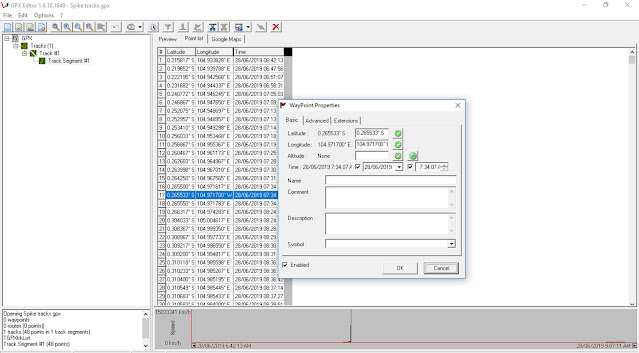
I have used and really like this program and know a couple of other cruisers who swear by it, one in particular has a hobby collecting others information and creating cruising/anchoring guides to share. This program is great for changing the data in tracks to remove spikes, or even removing excess data. I like this program to view my GPS performance, it’s easy to keep an eye on a track to see how jittery or smooth the GPS positioning is. The routes tracks and waypoints can also be displayed on a world base map to give you an idea of their position.
 |
| GPXeditor used to check a track overlaid on an open source map |
 |
| Inspection of a track into a Lagoon, using the open source map, your probably not going to use this for navigation but at least you know it is in the right place even though it lacks detail |
GPXeditor blurb form the host site: Load, modify and save your GPX 1.1 files. Add and remove waypoints, edit track and routes, simplify tracks (reducing file's size), clean recorded data, add and edit GPX metadata, edit waypoint, route and track properties, all with real-time preview.
GPX See
A handy program to view GPX files. It also supports file formats like FIT, GPX, NMEA, LOC and JPEG that are geotagged. This program will also open for view, the popular .mbtiles and .kap files. These two file formats are the most popular used for making satellite photo charts for use with OpenCPN. I find its a good way to check the created chart is clear and readable with out firing up OpenCPN and adding the files into the chart directory.
You are also able to check elevation temperature, heart rate and power if recorded. Great for those with FIT watches. This program will display your waypoints, tracks and routes on selectable base maps. Very handy as a crosscheck, as there is the possibility to graph different information contained in the file.
 |
| A satellite photo chart displayed in GPXSee, great way to view the chart rather than upload it to the navigation system |
 |
| GPXSee used to check a track overlaid on an open source map |
 |
| Inspection of a track into a Lagoon, using the open source map not a lot of detail this time. |
Garmin Mapsource
The Garmin Mapsource is used to up and download files from Garmin products, in our case we have Garmin GPS H72 and the later GPS 73 handheld units. I believe Mapsource will do the whole range of Garmin units, especially useful for the ones with a USB connection, I have been told it will also work seamlessly with the older serial units with Garmin format turned on. I don't have any problems manipulating and editing GPX files with this software. Map Source will also open and save in several formats: gdb, mps, gpx and loc.
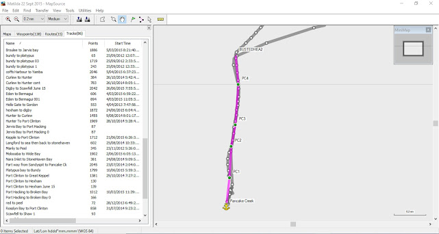
I have used Mapsource and GPX Editor to edit waypoints. There is also a function to display the routes, tracks and waypoints on Google Earth which makes it extremely functional when passage planning. To do this you need to have Google Earth Pro Ver 7.3.1.45 , this may take a bit of searching but is available from the Google Earthsite. https://support.google.com/earth/answer/168344#zippy=%2Cdownload-a-google-earth-pro-direct-installer Select the correct one for your system from the list of direct installers.
The creation of waypoints and Routes is simple and the waypoints can also have web links embedded into the properties. While it is possible to add a variety of icons to the waypoints they do not travel to other navigation programs and in most cases when opened will have the default icon of the system assigned.
 |
| Tracks into Pancake Creek shown overlaid on Google Earth by the Mapsource Program. |
 |
| Passage Planning, or sharing with others, after creating a route from a track into a Pancake Creek entrance and then overlaying it on Google Earth using Mapsource. |
Recently I uploaded a large GPX file Cruising Guide (over 200 waypoints) to my Garmin GPS 73 using Mapsource, the waypoint icons are not the same but for a screen size of the handheld it doesn't really matter. The routes tracks and waypoints can be displayed on Google Earth to give you an idea of where you’re going or have been.
 |
| Checking where we have been our track displayed on Google Earth using Mapsource. The same track into the lagoon as seen on the previous programs. |
While I have said its possible to display the information on Google Earth the right version of Google Earth needs to be installed, the newest versions don't connect with Mapsource but I know Google Earth Pro_7.3.1 works with MapSource Ok. The only thing to keep in mind is if you also use Chrome you will need to disable the option to automatically update Google software. If you don't the next time you want to use the GE program, if the PC has been on line its almost guaranteed Google Earth will have upgraded without any input from you.
I have on numerous occasions joined short breaks in tracks, or removed the odd position spike with the Mapsource program. While its not possible to edit the actual waypoint numbers you can remove it if it is causing a problem. Some of the other programs GPXeditor and Wordpad can edit the numbers and signs in the coordinates.
 |
| Data spike may have been caused by the navigation system missing the sign on the coordinate |
 |
| Editing and viewing data spike, in this case using Mapsource I can really only remove the spike waypoint, there are options to actually fix the spike in other programs mentioned earlier. |
https://www8.garmin.com/support/download_details.jsp?id=209
Here is an easy way to install the program on a windows computer. Download MapSource software updater from Garmin.
Reef Master Sonar Viewer
For those of us who have chartplotters that can save out the sonar file or log using .SL2 format there is only one program I found to be useful. Unfortunately it’s not free like the others listed above, however it does have a free trial period. The other drawback I see is that once you download your sonar file and overlay it on the small chart (world base map) there is no way to then save it as a chart usable by the chart plotter or OpenCPN for navigation (unless I am missing the point).
It is easy to use and may be helpful if you’re trying to explore new territory with the tender before you take in the deeper draft vessel into.
https://reefmaster.com.au/index.php/try-sonar-viewer
The Advanced Option:
A Text Editor that can recognize XML format files, which .GPX files are based on the likes of WordPad or Word to name two of several. I will say this is the advanced option because there are options to edit any part of the file.
Below is some sample text from a .GPX file opened in a text editor. As can be seen it’s not for the faint at heart. One syntax error and the file may open correctly when returned to the chartplotter/GPS receiver. Always make a back up before doing an edit, if you realize that the file has been corrupted in some way during the time you have it open, just close the program and dont save the file. The file can then be reopened to continue with the edit.
That said I love to edit files with this option because I can change bulk information using the search and replace. I have on occasions changed all the waypoint icons or been a little more specific with what I was searching for and replaced ones that meet only certain criteria. The good part about the search and replace is I can change a thousand entry's in a number of seconds. The same process doing it one at time would take hours.
The same can be done for editing individual waypoints. For a while my GPS receiver decided to toggle the east and west sign randomly resulting in large data spikes. Searching through the record is easy using the search function, if for example you are looking for a specific waypoint name, or coordinate, or for that matter waypoint icon. Using wordpad to edit the file, I could edit the way point in question and correct the sign of the Longitude easily.
Always make a backup of the file before editing, and when you have finished the edit push the save key/button, not the save as key.
 |
| A page grab of a GPX file open, while it can look daunting as long as your careful then editing this way is quick and easy. |
 |
| When you have finished the edit push the save button as shown here, then to close the file X off the window. |
OpenCPN
OpenCPN can also be used to save off specific sets of waypoints, tracks and routes. Actually editing the track files by removing or modifying positional data is not possible. Adding data (links and information) to the waypoints is extremely easy as is assigning a variety of icons to identify the waypoint type. Routes can be modified and waypoint added or removed to dodge obstacles or give a better track to the destination.
Another nice feature is the ability to include information including the local tide station, and at what scale you can have the waypoint disappear from the chart to reduce clutter. There are also hotkeys to hide other chart features, a quick link to hotkeys to reduce clutter here.
Keep in mind all the nice waypoint symbols available in OpenCPN will be lost if you open and save the GPX files with any of the programs listed other than WordPad or OpenCPN. However, you can open the waypoints and select the waypoint icon once uploaded into OpenCPN.
 |
| Creating a link to a cruising guide stored on the local PC to open at page 22 |
A guide to creating your own links to a cruising guide or even a website (internet connection required)
 |
| The finished link in the waypoint properties, tide station information and scale information can also be stored in a .GPX file created on OpenCPN. |
 |
| Another view of the information stored in Waypoint information text box |
 |
| OpenCPN Track that has over 30 thousand miles caused by large data spikes that can be removed or repaired by some of the programs listed. |


No comments:
Post a Comment