
A valuable tool
Undoubtedly satellite images are a fantastic useful tool for cruisers seeking greater accuracy in navigation. For us, satellite imagery increases the precision when we passage plan and allows us to explore remote areas, which we have found is usually most places out of the major shipping lanes and ports. We are able to find secure anchorages off the beaten track and ultimately this augmented navigation presents safer cruising. Now after using these satellite images/satellite photo charts it would be hard to think of navigating to new destinations without it. Practice makes perfect, and better forward planning and safer route selection does have its rewards as we enjoy safer navigation on our sailing adventures.
1. Missing data
With most satellite data providers all the major landmasses and their coasts are well covered, however some are covered better than others. There are still small islands, shallow reefs and dangerous rocks that are yet to be covered or should that be uncovered in remote areas. Sea areas without satellite imagery are coloured a hazy blue, AKA the Google Cloak, this can be seen on all the Google Earth satellite photo ocean areas. This has the potential to be misleading, do not assume this hazy blue area is safe, deep water. Even if your charts were made based on an old datum, look over your charts (paper or electronic) for guidance, there may be small islands, reefs or obstacles that have not yet been detailed in the satellite photos. Some of the time small reefs or even islands can be seen on the satellite photo cloaked area as an indentation, and requires investigation. Given time, we hope more and more of these areas are covered, and the cloak can be removed. While this sounds great remember the product name is Earth and not Sea so submerged reefs in some areas will more than likely never be shown.
 |
| The Cloak covering two small islands, the area selected here was to demonstrate the cloak and sometimes there are no clearance holes. Here the official chart of the area must have shown islands, and their charted location was uncloaked, however their position on the official chart would not be correct on a WGS84 datum chart hence the uncloaking missing the islands real position. |
 |
| Another satellite image provider showing the islands un-cloaked, all providers have cloaked areas. It is worthwhile to check satellite photo providers to see if there are areas uncloaked that you will be travelling in. |
2. Image Clarity
This has to be one of the biggest issues when trying to either passage plan or make charts. Google Earth well for that matter most satellite photo providers focus is providing satellite imagery for populated regions and areas of interest, the number of updates made to the images is based on this criteria. Blurred or cloud covered images do appear and are not uncommon in the more remote areas especially in SE Asia, sadly this makes them little or no use for navigation. One way we try and overcome this is to use Google Earth, they retain historical images and by using a time selection slide bar you can view older images, these may provide better clarity. Another way is to use other suppliers, Bing can some times fill in the blanks. We use SASplanet and can select satellite photos from several different sources. That said there are still times when we just cannot find a clear shot.
 |
| Island shown, this satellite photo provider had clear images even zoomed in to show the coast details. |
 |
| Same Island from another provider, even zooming in did not improve the detail needed to make use it useful for navigation. |
 |
| Same island again, the images spliced together however the photos one side of the island were very blurry or lacked detail. |
 |
| All zoom levels of this remote island were obscured by cloud cover |
 |
| Different sat photo provider showing the detail of the same island good even at low zoom levels. It certainly pays off to compare providers. |
3. Cached Data Size Limit
One limitation imposed by the Google Earth program is a 2GB cache limit, which means it will fill your disk with up to 2GB of satellite imagery for use when your offline. Once you fill the 2GB space it will then delete the oldest or least used information to make space for the new images. If you intend to travel into a remote area and have filled the Cache with data you intend to use. At all costs keep your PC offline, turn off the WiFi, this way there will not be new data to overwrite the data in the cache. Its for this reason we also make satellite photo charts when we are passage planning before travelling. SASplanet also allows for cached data, and we like to also plan out the passage as well should some thing happen to Google Earth. With out doubt one function we do make good use of with OpenCPN is the function to display google earth along side of the chart. We get the depth data from the chart and the good visual from the satellite photo real time. The only draw back to using Google Earth for this is you require an older version of Google Earth to allow it to be displayed in OpenCPN.
 |
| OpenCPN running the Google Earth plugin, the satellite photo to the left and we were able to check depth on the chart on the right. In this remote location we were running Google Earth from cache. |
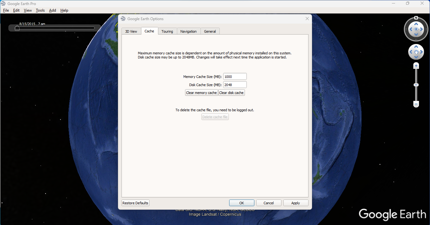 |
| Google Earth cache selection page, you can try and change the cache size but it appears even though it allows different numbers to be entered it doesn't actually change the storage size past 2Gb |
4. Location accuracy
While Google Earth uses WGS84 datum for referencing, errors can occur. We have heard of one cruiser who went to go through a passage in a reef in Wakatobi and when lining it up, he noticed it wasn't as on the satellite chart. After they were on the pick and back on line they started to compare their track to different satellite photo providers and found that the Google Earth satellite image was the only one out. (the channel in question did under go widening in 2016) Googles explanation was satellite images are a composite of multiple distinct frames which are then digitally combined and errors do occur. So we all need to be aware of this potential issue, and depending on the image's age things can change, channels re cut, bridges or jetties built or even whole islands can be reclaimed. During passage planning we lay our route on different satellite images as a secondary check. This is where SASplanet comes into its own we can check other satellite photo providers quickly and easily.
 |
| The track shows that we went in over the reef, lined it up and off we went. As it was a clear day with the sun over head I know we were near mid passage. While this could be blamed on the satellite charts, it could easily be a combination of errors including some GPS error. |
5. Depth and other data
Good quality satellite imagery can provide augmented accuracy out on the water. The limitations start with not having soundings, or navigation aids found on marine charts. However used in conjunction with marine charts these satellite image charts aid navigation and can show underwater obstacles totally missed by previous hydrographic surveys if there was one. While I have said the nav aids are missing from the satellite photos, if you can obtain clear satellite photos, zooming in can some times reveal the location of beacons, buoys, and lighthouses. We have done this on several occasions, if the buoy or beacon is on the chart we zoom in to see if its possible to get a visual on the satellite photo. Or we make a satellite image chart and can switch between the two using OpenCPN.
 |
| With a good clear satellite photo its possible to check the beacon and navigation aid locations |
 |
| The nav aid positions on both the chart and satellite chart can provide augmented accuracy. |
A RADAR overlay on the chart plotter can certainly help you confirm your position and can provide augmented accuracy. Where charting can be inaccurate, a RADAR overlay helps you confirm your position, based on plans made using satellite imagery, is right.
 |
| While I haven't shown a RADAR overlay, with a chart this far out it would very quickly show things are not positioned as they should have been. |
 |
| The same coast line as above but the vessels are displayed on the satellite chart. |
When closing land we pay particular attention to the RADAR overlaid on electronic charts, to confirm our position and to see if the chart matches what is really out there. We have experienced several instances where the chart is out. It can be unnerving when your chart shows your route is about to take you over a headland on the chart and we can breath a sigh of relief when radar and satellite charts confirms you are not. That user created satellite image chart or downloaded cache file was worthwhile.
We set depth alarms to warn us when the depth starts to shoal, we also set up alerts on the GPS to warn of upcoming hazards. It doesn’t take much to put in a waypoint and set up alarm guard radius to let you know your in the area of a hazard. At every watch change the person coming on watch checks the chart and zooms in on the route to ensure no surprises await. As often as we can we find its always best to zoom in the chart plotter every twenty minutes, the number of times we have heard people say we ran into an uncharted ‘whatever’ when in reality it was charted but not at the zoom level they were using. However that's not always the case but always try and zoom in on the satellite charts when passage planning does certainly help.
As we near our destination we will look over the satellite images on the laptop to familiarise ourselves with our destination. Keep in mind no tool is totally incontestable, even RADAR can miss things or not provide a clear picture, its only as good as its reflected target and we have seen some nasty targets that don't reflect a thing. At the end of the day, a look out (wearing good quality polaroid glasses) is still used more often than any other tool we have on board.
Navigating in the Digital Age a post on some of the tools we use aboard Matilda.
One mans datum is another mans ship wreck a quick discussion about chart datum
hi
ReplyDelete